North Gillespie Hike
The North Gillespie hike is probably the most remote route in the western
block of Grasslands National Park. Please read my general comments on
hiking in Grasslands National
Park and my list
of known errors in the published Guide book before proceeding.
The hardest thing about the North Gillespie hike is getting there.
We went through the eco-tour
drive and took the left fork at the Dixon "Y". The first
"bladed trail" to the left (north) was not the correct one
as it quickly veered off to the west and over a dry creek bed. Retracing
our steps, we stayed on the main road (if you can call it a main road)
until the choice was going into the Dixon Community Pasture compound
or turning left.
The road was in fairly good shape. We proceeded north along the Big
Breed Creek until the road turned east. At GPS coordinates 333,452/5,450,023
we met up with another road joining us from the northwest. On the Grasslands
National Park road map, this road is listed as a shortcut back to Highway
#18 east of Val Marie.
After we were done our trip, we decided to take this short cut. It
isn't a shortcut! Instead it took us northward through about
seven cattle gates (not Texas gates with the bars on the road; these
were barbed wire gates that country kids learn how to work), and miles
of boulder-strewn bladed trails until we came to a funky "Y"
junction at the bottom of the Big Breed Creek valley and took the east
fork to a gravel road that eventually dropped us off outside of Mankota.
Again, let me repeat, don't take the northwest road back from the hike.
Either go back via the eco-tour route or head east from Gillespie Corner
and take one of the better gravel roads north or east.
The road proceeded up through a valley until it came to Gillespie Corner
at 340,414/5,448,709. A "Gillespie Ranch" sign on this corner
marks the turn for those who don't have a GPS. Turning south at the
corner, you will find ourselves about to drive into a ranch yard except
for a dirt trail up a hill to the left immediately before the yard.
Yup, that's the trail! 6.3 km down this path is the trailhead. About
another 5 km past this is the incredibly scenic entrance to the Moleshead
coulee, but we'll leave that for another time...
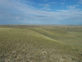
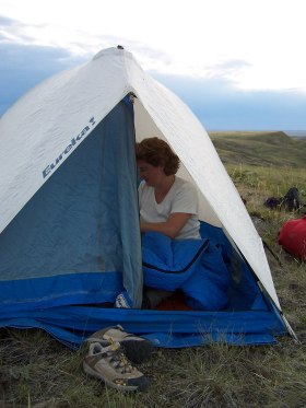
The hike is a 15.1 km hike. It's a good day hike but we decided to
turn it into an overnight. Evening and sunrise give the best views of
the park with the longer shadows and contrast in the terrain. They also
give a good opportunity to see the wildlife and simply experience the
overwhelming vastness of this magnificent landscape.
Numbered walking points correspond to numbered points on the map.


|
1. This is what Parks Canada calls a trail marker! It's a barren
fence post sticking up in the middle of the prairie: no sign,
no colour, no paint, no flag. And by the way, that's the "road
west" along the "former fenceline" mentioned in
the Guide book. Thank goodness one person refreshed that trail
this year. |
|
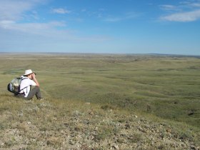
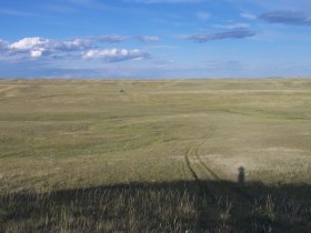
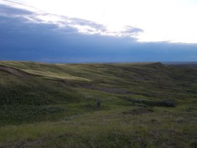
We're only about 300 m off the road but this is going to be
the last view of our car until tomorrow afternoon (it's the dark
dot near the horizon; I'm the shadow taking the picture). Take
a GPS bearing of where you parked. The return trip is no time
to forget what hill your car is behind! |
|
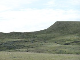
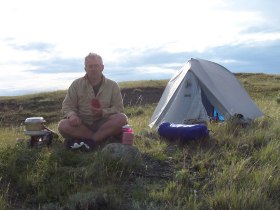
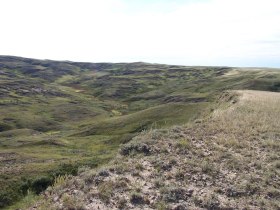
2. We made camp for the night about 2 km from the road and
looking down a small coulee leading into the Otter creek coulee.
Although it looks like rain is threatening, of course it isn't.
Our campsite was at 335,654/5,441,680. There was a small flat
stone that made a nice platform for my Coleman Peak 1 stove. |
|
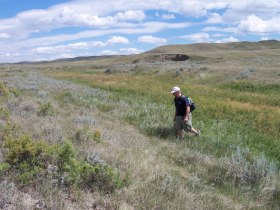
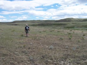
3. Leaving our packs at the campsite and taking a day pack
with lunch and water, we headed out for the North Gillespie loop.
At the ridge on Otter Creek valley, we looked back at where we
had camped the night before.
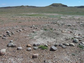
Although it's just a hunch, I'm quite convinced that this viewpoint
is actually a bison jump. The slope is steep enough, the drive
lanes are wide and easy to lure a herd of bison down, and there
is plenty of space down the hill for the kill site. The GPS coordinates
of this jump are 335,165/5,442,079. If anyone has a thought on
this hunch of mine, I'd be interested in hearing
about it. |
|
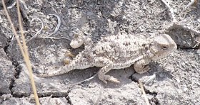
4. Although Grasslands National Park is very dry, Otter Creek
is a bit of an exception. Here you can find some small pools of
water where animals will slake their thirst. We came over a small
rise and surprised a coyote about 40 m from us (the coyote wasn't
the only one surprised)! I couldn't power up the camera in time,
but I'm glad he made the decision to run away from us. |
|
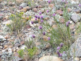
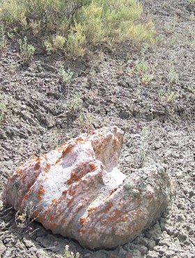
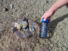
5. The top of Little Breed Creek ridge was a barren windswept
place marked by bentonite clay and these strange geode like rocks.
The water bottle is included for sizing. |
6. As we rounded the valley wall to turn east, a creek cut
through the valley and we needed to find an easy way across the
pools of water that were there. Be careful in the tall grass of
the valley bottom. It's easy to twist an ankle in the eroded trenches
and ditches hidden by the grass. |
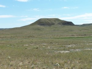 |
7. "Downtown" prairie dog town is due west of this
hill on the north and west side of the valley. It was here that
I discovered the errors
in the Guide book's maps. It took about 15 minutes of compass
bearings, and GPS readings to convince myself that I was west
of this hill and not south. I'm still not convinced that the topographic
lines on the map are accurate, but I haven't picked up a proper
NTS series map of the park yet. |
 |
8. Returning to Otter Coulee by a more southerly pass, we crossed
the creek again, and picked up our packs before heading back to
our car. 2 litres of water per day per person may not be
enough in the hot winds of Grasslands National Park. We were glad
to have two extra litres waiting for us in our car. |
Back to Hiking
Trails
Back to the Grasslands National
Park Visit
|